|
Maps (Chizu, 地図)
"Road Atlas Japan"
"Road Atlas Japan" published by Shobunsha Publications,Inc(昭文社) , covers all over Japan, so this must be the best map for foreign cyclists.
It is a Japan map of 1:250.000 scale, cost about 2.857 yen. It is written in Roman letters with some Japanese letters for cities.
You may not get lost if you checking your way with this map unless you enter a forest single track.
 Shobunsha Publications,Inc Shobunsha Publications,Inc
You can view a sample of the "Road Atlas Japan" in the site.
 OMNI Resources > Japan-Road Atlas Japan OMNI Resources > Japan-Road Atlas Japan
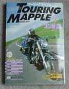
"Touring Mapple"

This is the very atlas almost all Japanese riders are equipped with. It is very useful with telling not only distances, but also course conditions(paved or not), camping ground(Kyanpu-jo,キャンプ場), youth hostels, accommodations, Hot-springs(Onsen,温泉), view points, contour lines and so on. They are kept having a revisions so that contain up-to-date information.
Although it's written only in Japanese, it could be worth having even if you don't read texts. You could get necessary information from it's graphical icons as positional information which are interspersed all over the pages and a different color for each road condition.
Legend1, Legend2 (2004 Edition)

You might want to get Touring Mapple while sitting in the comfort of your home, to use it as a data for planning a tour.  Amazon.co.jp , of course they provide services mainly in Japanese, but also provide English pages for ordering transaction and accept a international shipping from Japan. If you'd like to purchase, follow these steps; Amazon.co.jp , of course they provide services mainly in Japanese, but also provide English pages for ordering transaction and accept a international shipping from Japan. If you'd like to purchase, follow these steps;
- Touring Mapple consists of 7 volumes by region. Choose the atlas what you need, then click the book jacket below. Don't click any other link. That cause confusing you if you don't read Japanese.
- Hokkaido (北海道) Touring Mapple
- Tohoku (東北) Touring Mapple
-
- Including Aomori, Iwate, Akita, Miyagi, Yamagata, Fukushima and north part of Niigata.
- Kanto/Koushinetsu (関東甲信越)Touring Mapple
-
- Including south part of Niigata, Ibaraki, Tochigi, Gunma, Nagano, Saitama, Chiba, Tokyo, Yamanashi, Kanagawa and Shizuoka.
- Chubu-Hokuriku (中部ー北陸) Touring Mapple
-
- Including south part of Nigata, Nagano, Ishikawa, Toyama, Gifu, Aichi, Yamanashi, Fukui, Shiga, west part of Kyoto, north part of Wakayama, north part of Mie, north part of Nara, Osaka.
- Kansai (関西) Touring Mapple
-
- Including south part of Ishikawa, west part of Gifu, west part of Aichi, Fukui, Shiga, Mie, Nara, Wakayama, Kyoto,Osaka, Hyougo, Tottori, Okayama, and Kagawa.
- Chugoku/Shikoku (中国・四国) Touring Mapple
-
- Including south part of Hyougo, south part of Kyoto, Osaka, Tottori, Okayama, Shimane, Hiroshima, Yamaguchi, Kagawa, Tokushima, Ehime and Kouchi.
- Kyushu-Okinawa (九州ー沖縄) Touring Mapple
-
- Including Fukuoka, Saga, Nagasaki, Oita, Kumamoto, Miyazaki, Kagoshima and Okinawa.
- All Japan (全日本) Touring Mapple
-
- This version is 2012. 2013 version is still not available on 1st July 2013
- Now you may be seeing Amazon's corresponding page in a new window. Make sure the title and book jacket are as you have choosen. If it's correct, click the book jacket in Amazon's page.

- Then book information page appears. Look at the right side of the page. There is a link saying "Display in English". Click it.

- English cart button appears. Click it, then ordering transaction in English will be beginning. Go on through procedure.

Topographic maps
Topographic maps(chikeizu, 地形図) is also available in scale from 1/25,000 to 1/200,000 covering all over Japan. 1/200,000 scale is the best for most of us, and 1/50,000 is also good if you would like to go to a forestry road.
Remember that topographic maps are laid stress on figuring geographical features. As a result, for instance, the dotted lines on the maps which are drawn as mountain trails are quite unreliable and even 1/25,000 scale maps have poor depiction of center of the city. Though it's useful for general touring.
These are available in major book stores or  online. The samples are online. The samples are  here and online browse system is here and online browse system is  here. (Online browse system is in only Japanese.) here. (Online browse system is in only Japanese.)
 Geographical Survey Institute in Japan[E] [J] Geographical Survey Institute in Japan[E] [J]
Web map of bike paths
The bike path(saikuringu roodo,サイクリングロード) in Japan, which is for the exclusive use of bicycle, is not sufficient in the sense that of both quality and quantity. Some routes are really like bike highway, but some are like a sidewalk or a gravel road.
Bike paths are developed by  MILT(Ministry of Land, Infrastructure and Transport Government of Japan). Conceivably, MILT(Ministry of Land, Infrastructure and Transport Government of Japan). Conceivably,  their flash map could be of some use. A legend of the map is that; the solid line represents available route, the dotted line represents the route which is now under construction. their flash map could be of some use. A legend of the map is that; the solid line represents available route, the dotted line represents the route which is now under construction.
  MILT [E]>Bike path map[J] MILT [E]>Bike path map[J]
Web map written in Roman character
 JNTO provides web map written in only Roman character. It's not a bilingual map. JNTO provides web map written in only Roman character. It's not a bilingual map.
 JNTO [E]> Map(index page)[E] JNTO [E]> Map(index page)[E]
MapFan Web
"MapFan Web" is free web-map services in Japan.
 MapFan Web MapFan Web
uploaded:01, 07, 2013
|


 Shobunsha Publications,Inc


