
|
|
|
|
Ads by Infohub
Partnership with TGCT
Mutual Support with JCA |
Fukuoka - Tokyo : Attractive route with many attractions
Images of Nikko - TokyoNikko and Hosoo Pass (320*240 pixels 7.3MB) (Nikko-Tokyo)Summary
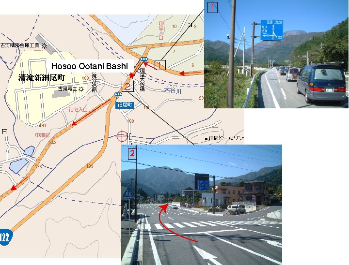
DetailCopper road:Hosoo PassAfter visiting Toshogu, go back about 7 km in the direction of Irohazaka . This will enable you to escape the Nikko area, by climbing over Hosoo Pass (細尾峠).
Soon pass under the bridge of "new" R 122. Next to it, cross the bridge again while, this time, looking down on the "new" R 122. Make sure you don't wander onto this "new" R122 which leads to a 2.7 km long tunnel.
Hosoo Pass is frequently closed to traffic due to fallen snow. In winter, you are supposed to run through the long tunnel on the "new" R 122. Old Hosoo Pass was the arterial road between Nikko and Ashio until quarter-century ago. Many people of Ashio Town carried the copper to Nikko over the Hosoo Pass road. It was the material used for the beautiful architecture of Nikko. Thanks to this former traffic, this road is wide enough, as yet and not so steep, considering it had been constructed prior to the motorization age.  Ashio TownFrom the pass, you can take a view of a big valley. After taking rest, start the fantastic down hill run. Free-wheeling from a mountain pass is just so, so, good. After descending, the road will meet the "new" R 122 again, and the old road is terminated. From here, pedal along the "new" R 122 until Omama town which is 50 km from Hosoo Pass and is the gateway to the Kanto plain.
This Ashio copper mine was discovered in 1610 (Edo Era) and this city developed over 400 years. The copper was sent to Edo (Tokyo), Nikko, and overseas. Ashio town was once a larger city with a population of 40,000 but the copper industry was closed during the 1970s. Ashio became a quieter city. A good option is visit the museum Kiryu City
Now we're standing at a gateway to the broad Kanto Plain (関東平野). It has large population. About 30 per cent of Japanese people live here. Also, traffic is heavy. To avoid a traffic jam, we suggest using a major bike path – an exclusive road for bicycles. This route is much longer than taking R 122 to Tokyo, but much safer, more scenic, and definitely much more fun.
Remember that these bike paths can be confusing. Even Japanese cyclists are easy to be lost. You will l have to cross a lot of bridges, looking out for them, but we promise you an amazing ride.
Ashikaga City

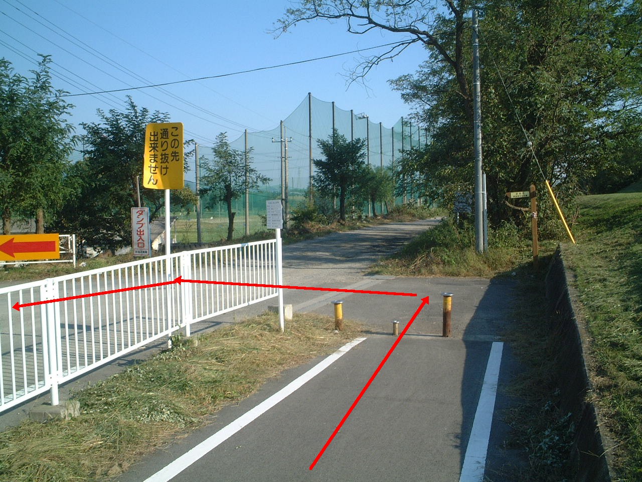
Next to it, we can get back to the bike path from carriageway. About 300 m from the red shrine gate, is a small bridge crossing an equally small river. After crossing this bridge climb up the bank of the big Watarase River(渡良瀬川). And so you will be back on the bike path which extends along Watarase River once again.
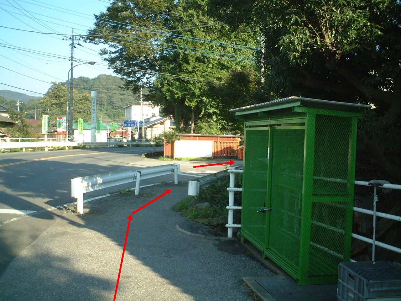
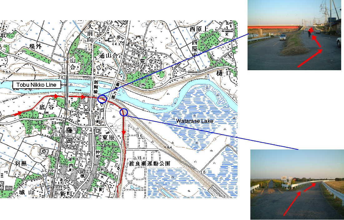
From Tanaka Bashi Bridge, it is very easy to follow the bike path. Once the bike path crosses the Watarase River, it keeps to the south bank all the way. Watarase Lake (渡良瀬貯水池)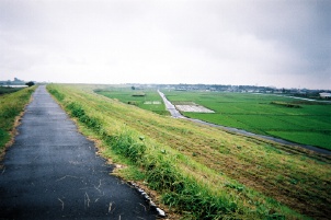
Ride along west side of Watarase lake, and you will see the Michi-No-Eki Kitakawabe(道の駅 きたかわべ)Road Station on your right. This is quite new, so it doesn't appear on most maps. After leaving this rest area, a distance post "3.5 kilometers" will appear. It's about time to cross the river. Near the distance post, Mikuni Bashi bridge(三国橋) is found. Cross this bridge, then go on riding the bike path which extends along east bank of Watarase River. When you look at the map, you might be tempted to ride the center lake road. That would be a nice option - but the west-side road is the better place for beautiful scenery. Tone River
After crossing the bridge, go almost 2 km on the carriageway. Another bridge Sekiyado Bashi (関宿橋) will appear. Edo RiverCross the Sekiyado Bashi bridge (関宿橋).The Edo River Bike Path starts from west side of the bridge. There are some larger supermarkets and convenience stores around this bike path. Near "50.5 km" distance post is a supermarket named Maruya Super (マルヤスーパー)at the other side of a Houjubana Bashi bridge (宝珠花橋) which is about 6.3 km from Sekiyado bridge. Near the "20.7 km" distance post is SATY supermarket (center of Misato City, Saitama Pref). You can use the toilet (rest room) in these stores even if you do not buy something. Supermarkets usually open from 10 am daily. And convenience stores open 24 hours a day so that you can use the toilet and buy supplies even if you ride on early in the morning. Japanese Convenience Stores are the greatest thing since sliced bread. They provide a bicycle traveler’s breakfast, toilet, lunch, afternoon ice cream, evening meal with beer and sake, Vodafone top-up, stationery, interesting novelties, and a great smile from staff members. Many Convenience Stores have a post box outside – just the correct height for a Westerner’s early-morning breakfast table.
(Comment added by cyclist Roy Sinclair from New Zealand, in 2000.) The bike path along Edo River extends to Tokyo Bay. But here we'll take you on a tour to central Tokyo by diverting from the bike path.
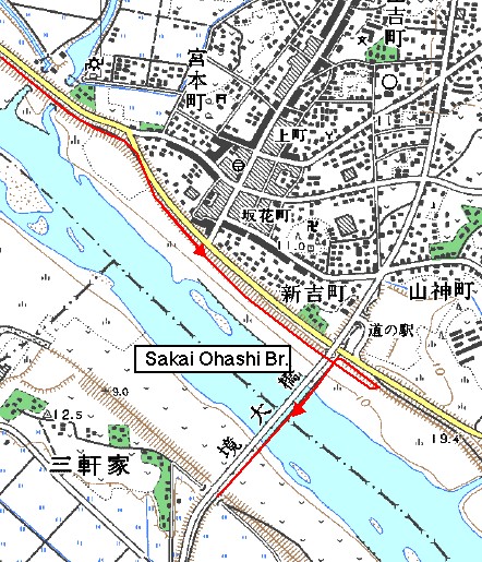
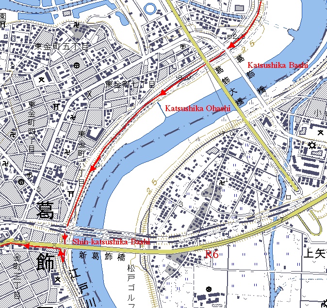
To go to central Tokyo, take the R 6 from Shin-Katsushika Bashi bridge (新葛飾橋). The way is the same as from Sakai Ohashi bridge. First, pass under the bridge, then turn back to the bridge.
R6Take the R 6 to the west. This road takes you to the middle of Tokyo via Asakusa. R 6 is, of course, a busy road but the road is wide enough. Follow the signboards that saying "6" and city names, such as Asakusa(浅草) and Nihonbashi(日本橋). Once more you need to cross the bridge, Kototoi Bashi (言問橋) as turning to the right. After crossing the bridge, turn to the left as shown by the signboard. The final destination of this "Length of Japan" Part 1 is Nihonbashi Bridge(日本橋). That has remained as the origination of all roads of Japan for 400 years. You might come across signboard that said "Nihonbashi (日本橋)" even if you were some distance from Tokyo. That was how it once was. Since this historical bridge is buried in a busy business district these days, no one could feel nostalgia for it. But you, who made a pilgrimage and arrived, will likely feel a well-deserved emotion of some kind. Kanpai!  Route
Climate data for Tokyouploaded:14, 04, 2019 |
|||||||||||||||||||||||||||||||||||


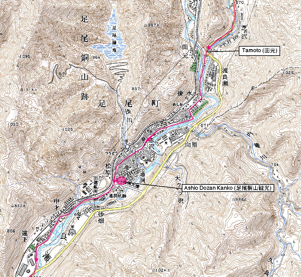
 Ashio Dozan Kanko
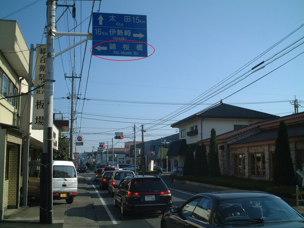


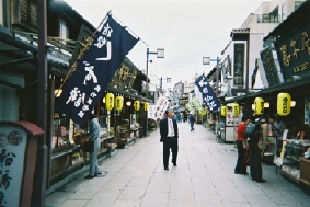 (If you are interested in a historical shopping street on the river side, Shibamata Town, leave the bike path at the "7" distance post. Traffic is light enough. Cross at the crosswalk, and go down the slope and turn right. You will see Shibamata shopping street is on your left, just after a 50 m ride.)
|
|
|
Copyright "Japan Cycling Navigator". All
rights reserved.
|
